
After three days of rain and clouds, it's refreshing to wake up to a crisp sunrise glaring through my hotel's curtains. I grab breakfast at Flood City Cafe, then I'm off to the airport to prep for an 8 am departure. The sky has a few scattered clouds as my Warrior climbs to cruising altitude.
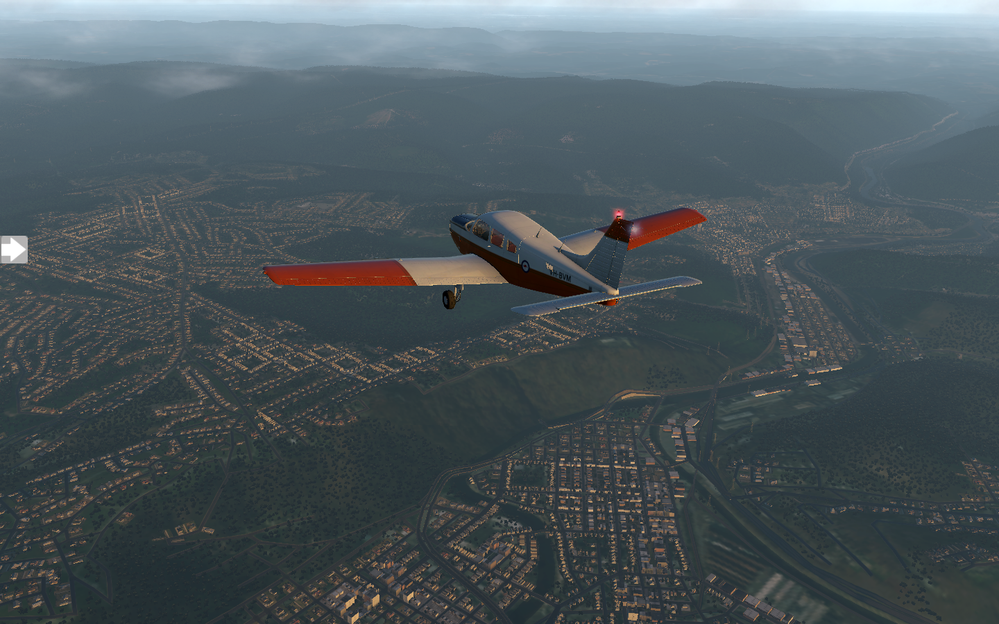
For most of the trip I fly at 6000 feet, the clouds above me at 9000 feet, until I get closer to my destination. Puffy cumulus clouds roll in underneath me. I descend below them.

Wheeling, West Virginia is a bit misty as it comes into view, but visibility is good and I have no trouble with the approach to KHLG.

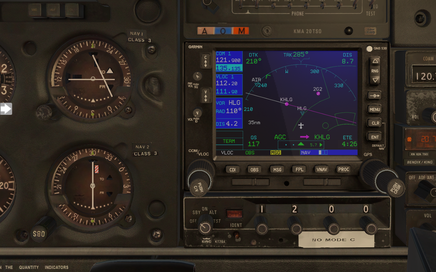
To help me with that approach, I discover the Garmin OBS function, which allows me to link the OBS knob from my NAV1 gauge to the GPS. This means I can set my desired approach angle for the runway and have the GPS display it a a line. When I come near the line, I just need to turn into it and I'll be perfectly lined up with the runway.
Incidentally, did you know that runway numbers are the rough heading of the runway? Runway 9 has a heading of 90 degrees (relative to magnetic north). Runway 12 is 120 degrees. The real runway angle may be 91.2 degrees (you get it from the FAA airport map), but 90 will get you in the ballpark.
Wheeling is a charming city which was the original capital of West Virginia. I take some time to explore the Wheeling Suspension Bridge, built in 1849. After a bit of sight-seeing it's back to the airport for a noon departure. There's not a cloud in the sky when I take off.

Most of the route is very rural, and pretty.

It turns out that where I'm heading, KVTA Newark, Ohio, has an NDB (non-directional beacon) located right near the airfield. My Warrior has an ADF (automatic direction finder) gauge which I have not used yet. I look up the NDB frequency and tune it into my King KR85 unit. ADFs work a bit like those hand-held trackers you see in old spy movies. The needle points in the direction of the signal. When the needle points up, you're going straight towards it. I rotate the card on my ADF to match my current heading so that the needle points to the heading of the signal.

ADF - bottom left gauge. My little plane stick figure should fly in the direction of the needle, which in this case is straight ahead.
I also discover my Garmin has pre-programmed approaches and departures for each airport. This makes life even easier.

Regardless, I still dial runway nine's localizer into NAV1. A turn on final and a smooth landing, just as clouds start to roll in. I spotted something that couldn't be real as I made the turn, and made a mental note to ask about it on the ground.


The locals point me in the direction of the thing which couldn't be real: a giant basket as big as an office building, complete with windows. A short cab ride takes me there, and I tilt my head towards the sky to check it out. It's a giant Longaberger basket. More specifically, it was the headquarters for Longaberger, opened in 1997, sold in 2018. A smile pulls across my face as I feel like I've been shrunk in a sci-fi movie,