Hollywood Route Flight Plan
In my most recent Microsoft Flight Simulator 2024 video, I departed Burbank in a Piper Tomahawk, flew past the Hollywood sign, and navigated to KCCB Cable. Check out the video if you haven’t seen it.
FOR FLIGHT SIMULATOR USE ONLY. NOT FOR REAL WORLD INSTRUCTION
Our flight plan relies on easy-to-see visual waypoints, most of which are called out as VFR reporting points on the sectional (VFR reporting points have a flag icon next to them. They’re usually landmarks and if you tell ATC you’re near one, they’ll know where you’re at). We do have some airspaces to contend with, including the LA Bravo that we’d like to avoid, but a little carefully planning will let us fly over or around them. Because we’re flying east, I’ve selected our cruise altitude to be 3,500 MSL (when flying VFR easterly greater than 3000 feet above ground, pilots should chose an odd altitude in thousands plus 500 feet).
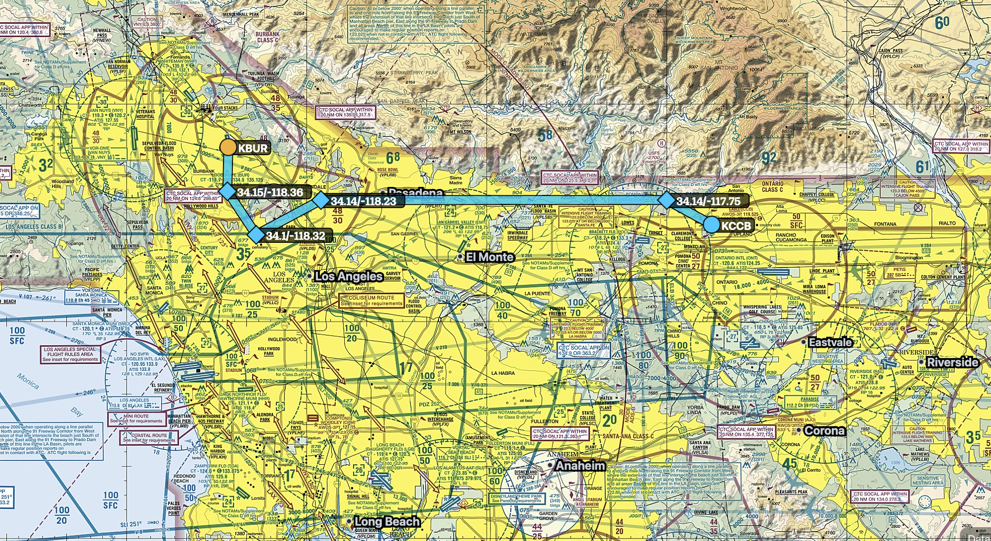
We’ll be departing from KBUR Burbank’s Class Charlie, remaining north of the LA Class Bravo, flying above the Class D airspace of San Gabriel and Brackett Field, and skirting north of KONT Ontario’s Class Charlie to arrive at KCCB Cable, a non-towered field
On the ground at Burbank, we’ll pick up flight following because it’s a busy airspace and it’ll be nice to have help from ATC. Burbank is a Class Charlie so the sequence of ATC calls will be:
Tune in the ATIS to get the current weather information
Call Burbank Clearance Delivery and request flight following to KCCB at 3,500 feet
Call Burbank Ground and request taxi for a south departure
Call Burbank Tower when holding short of the runway and request take off clearance
Call SOCAL Departure when tower hands us off to them to continue flying through the approach ring of Burbank’s Class Charlie, and then to continue with flight following
Switch to KCCB CTAF when SOCAL tells us
Self-announce position calls on KCCB CTAF until we’ve landed and taxied to the ramp
On departure we’ll fly south until we intercept Highway 101. You can see it drawn on the sectional southwest of Burbank. We’ll follow Highway 101 through the Hollywood mountain pass, looking to our left to see the famous Hollywood sign.
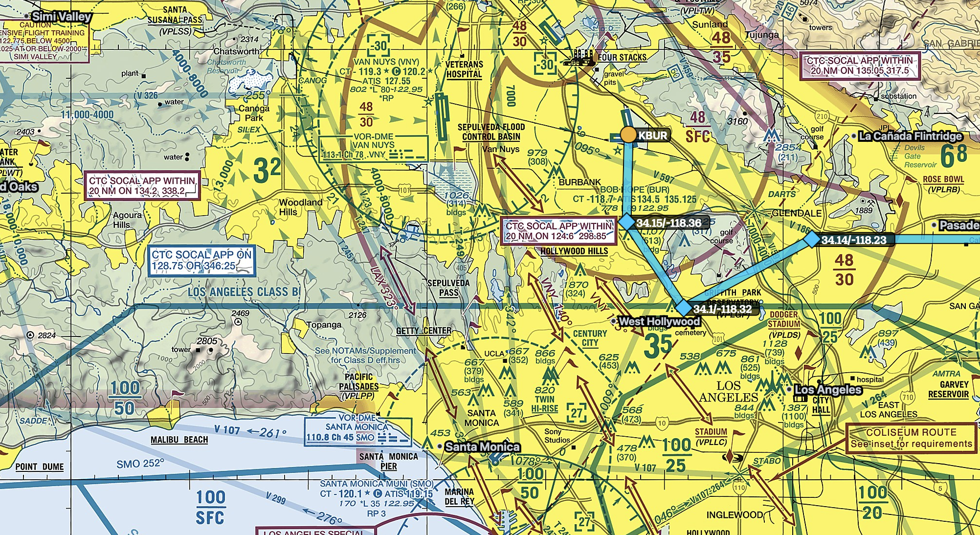
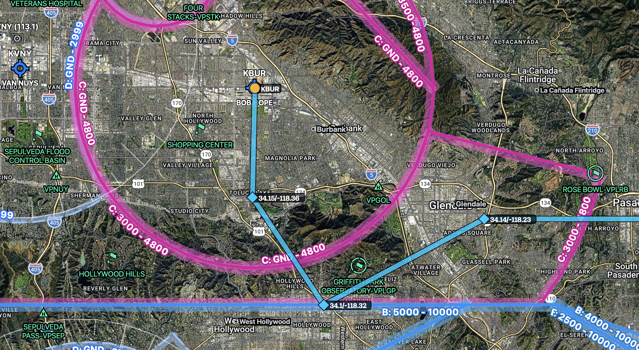
In Foreflight, I like to switch to satellite view when picking out visual waypoints. If you do that for the Hollywood mountain pass, you can see Highway 101 and also our next visual waypoint, Griffith Observatory, which is a VFR reporting point We’ll turn east when abeam Griffith and hug the mountain, keeping Griffith on our left. Just to our south, you can see the blue line of the LA Bravo with a starting height of 5,000 MSL. We’ll be cruising at 3,500, so this won’t be an issue, but as we proceed east the next Bravo shelf starts at 2,500. By hugging the mountain and staying north, we’ll avoid entering the 2,500 shelf. At 3,500 we’ll still be in KBUR Burbank’s Class Charlie, which is marked in magenta on the pic below, and we’ll exit it when we’re abeam the Rose Bowl.
Our next waypoint is Glendale, at the intersection of Route 2 and Route 134. This is a nice big x where the routes intersect and will be easy to spot. We’ll turn east and follow Route 134 until it merges with Interstate 210 East. Be sure to spot the Rose Bowl on our left, which as I mentioned marks the end of Burbank’s airspace. Our flight path continues east following Interstate 210 and we’ll overfly KEMT San Gabriel’s Class D airspace; however, its airspace only goes up to 2,400 MSL. We’ll be flying at 3,500 MSL and will not be in it.
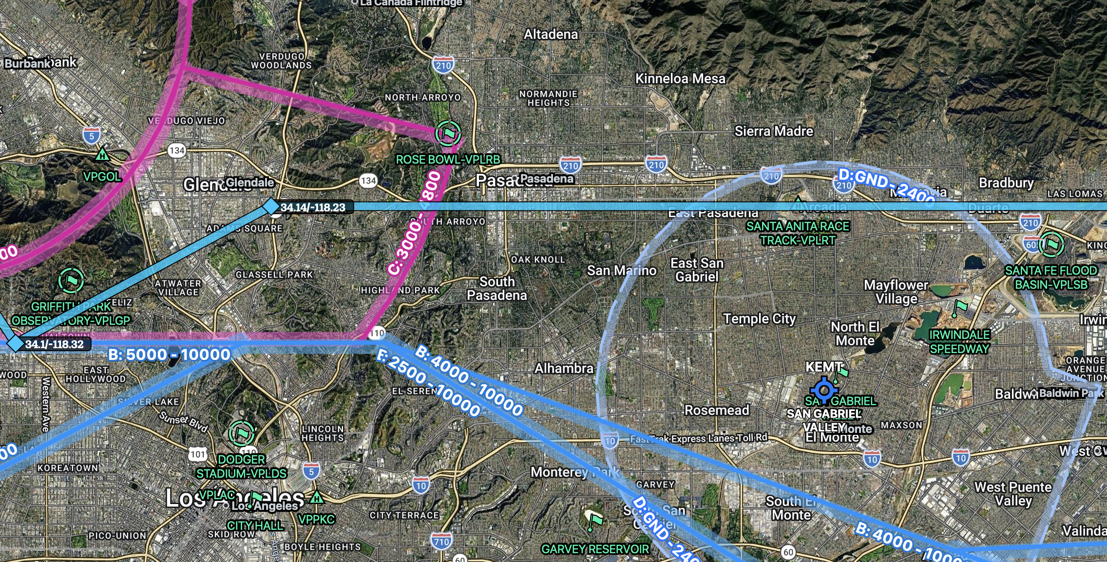
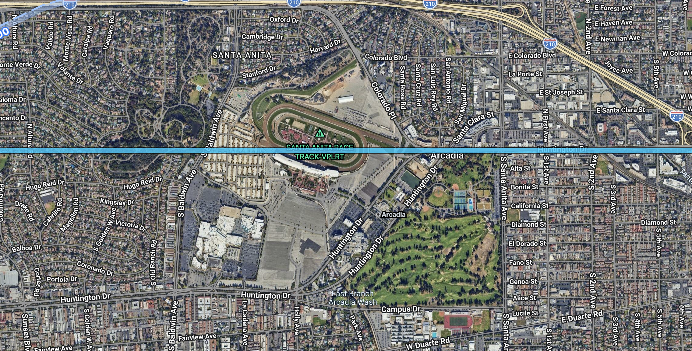
As we overfly San Gabriel, Santa Anita Racetrack is a nice visual waypoint on the northern end of its airspace. We’ll know exactly where we are when we see it.
Our next visual waypoints are the Sante Fe Flood Basin and Irwindale Speedway, on the eastern side of San Gabriel’s airspace.
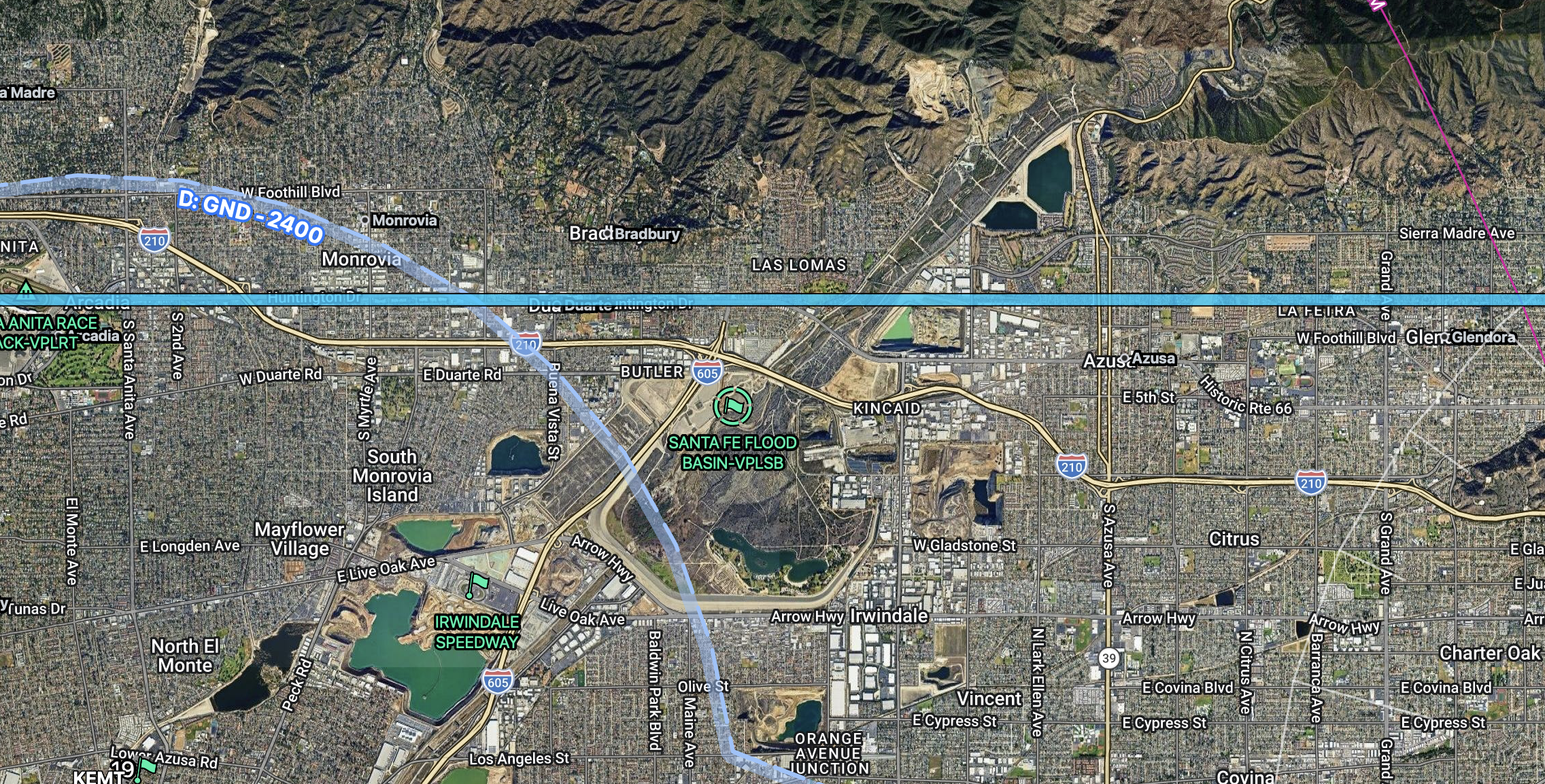
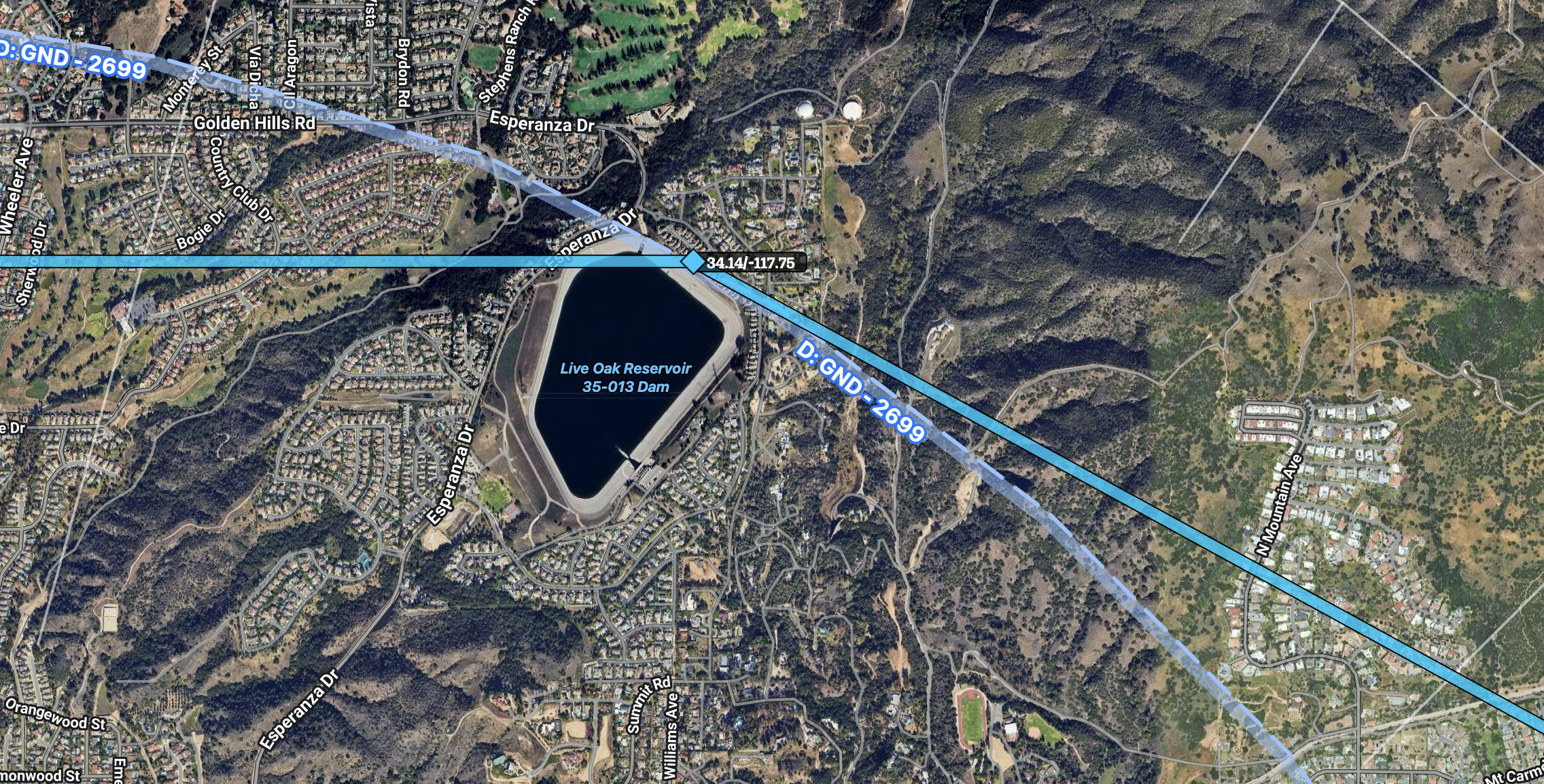
We’ll continue following Interstate 210 andl overfly KPOC Brackett Field’s Class D airspace, heading for the Live Oak Reservoir. By overflying the reservoir at 3,500 MSL, we’ll avoid KONT Ontario’s Class C, which is to the south of the reservoir. The Reservoir will be our cue to start our descent. Our plan is to approach KCCB Cable from the north.
KCCB Cable has published pattern entry procedures for noise abatement. You can find them on KCCB’s website, but for our north arrival to runway 24 we should overfly the numbers of runway 6 and break left directly into the left downwind for runway 24. Coming in from the north lets us avoid overflying the residential areas by approaching over the unpopulated water treatment areas.
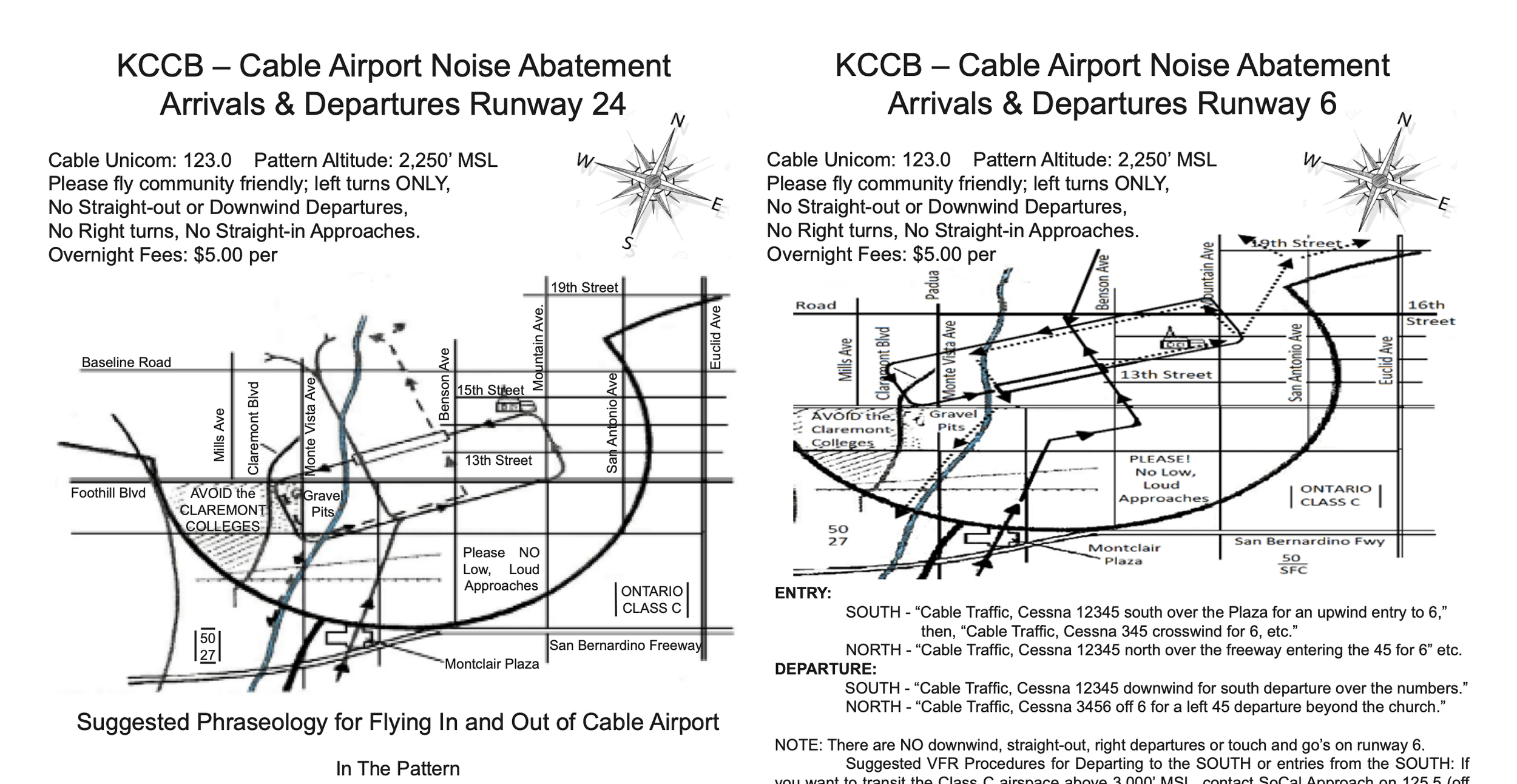
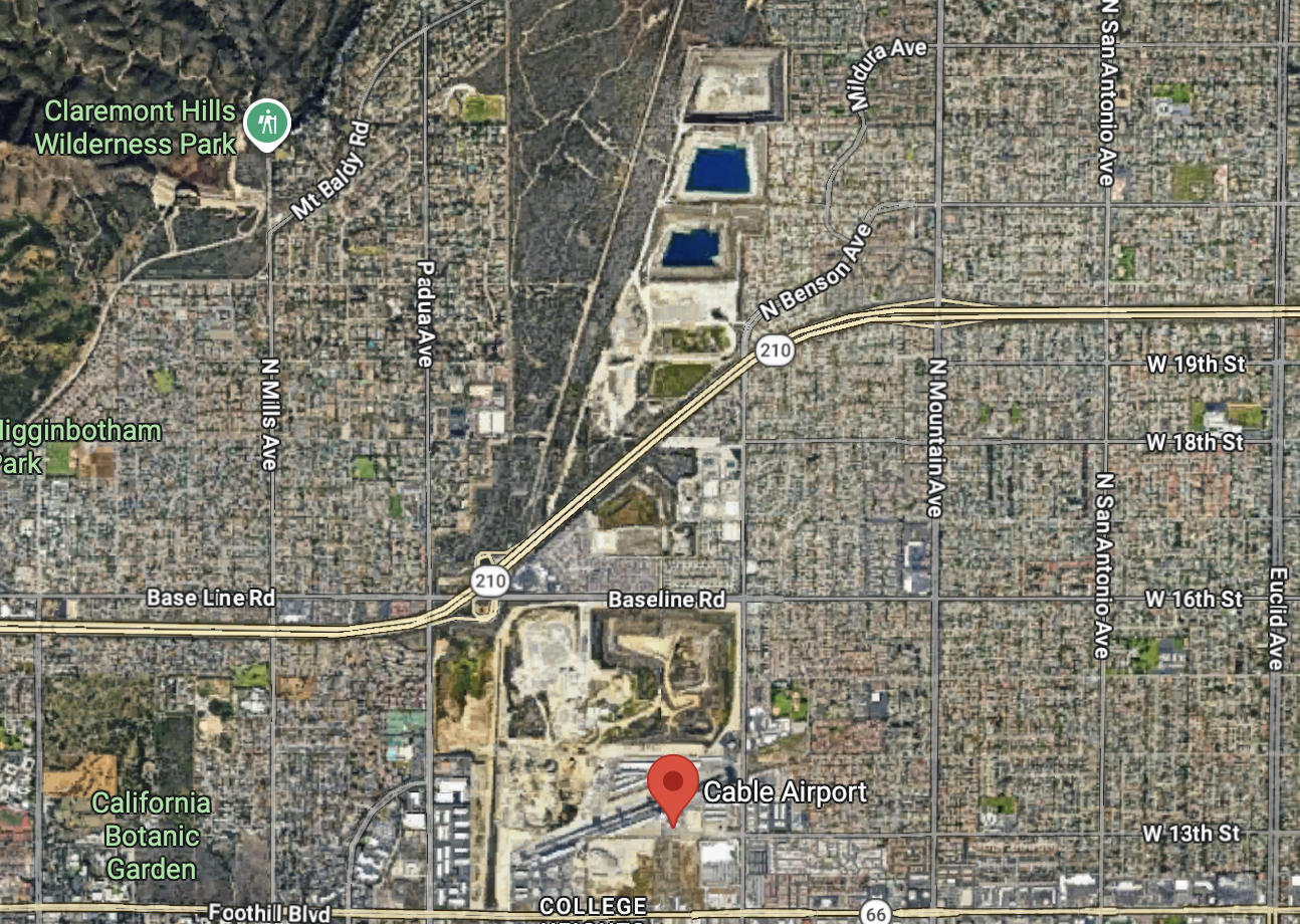
North approach to Cable from the top center of the map avoids all the houses
KCCB is non-towered, so we’ll need to make CTAF calls self-announcing our position. The CTAF frequency is the 123.0 number next to the C that looks like a copyright symbol that’s listed in the magenta airport text to the right of KCCB below.
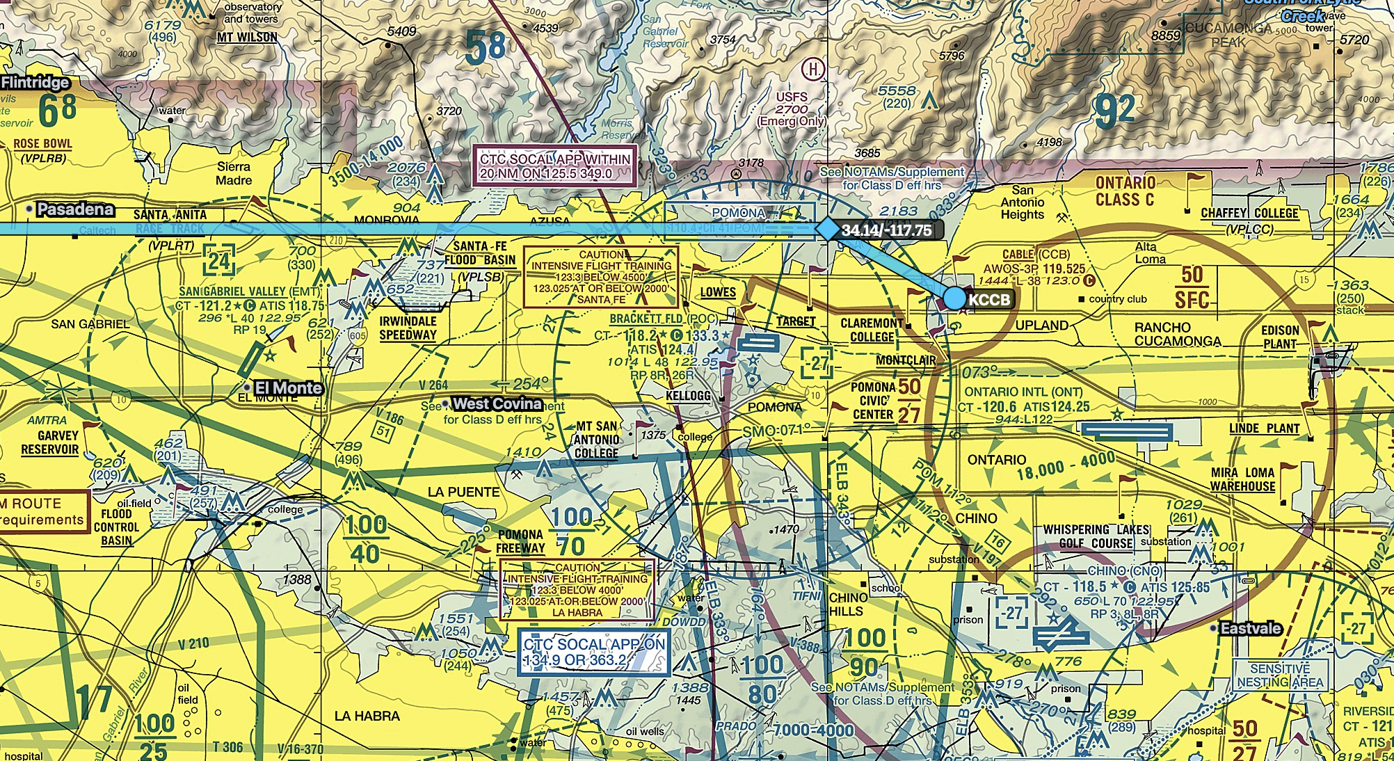
That’s it! Short and scenic. Give it a try - it’s great fun. For bonus points, hand fly it using visual references only.