The Grand Adventure
A few years ago I read Patrick Smith's Cockpit Confidential, a retired pilot's behind-the-scenes look at everything which happens behind the closed doors of aircraft. I was hooked, and, intensely curious. YouTube fueled my fire with channels dedicated to people showing their in-flight videos of pilot's training and first flights. One in particular showed someone being handed the controls of a single-engine prop plane and asked to land it with no flight experience. I remember him panning across the different controls and trying to deduce what each gauge did.
I wanted to know what each gauge did, so I downloaded X Plane and bought the virtual version of the same plane.
I've been virtually flying the past month, learning all of the details about how to start the plane cold, navigate via navaids and gauges, and land at different airports. When I took off from my local county airport, I was amazed at the detail in the simulations. It looked like where I lived, right down to the streets. I could find my house. In the advent of full-world maps like Google Earth, X Plane has a three-dimensional model of the world for you to explore. If you're really into authenticity, you can overlay it with satellite imagery. And, so, I find myself exploring places. Flying over the Golden Gate bridge and doing a circuit past Sausalito to Muir Woods and back, seeing the sights.

Flying the PA28 Piper Warrior II just north of San Jose
After fifty-plus simulator hours, I'm ready for bigger challenges. And, so, I've planned my grand adventure: flying coast-to-coast in my single-engine plane, the PA28 Piper Warrior II, and blogging my trip along the way.
I plan to keep it as authentic as possible. This means:
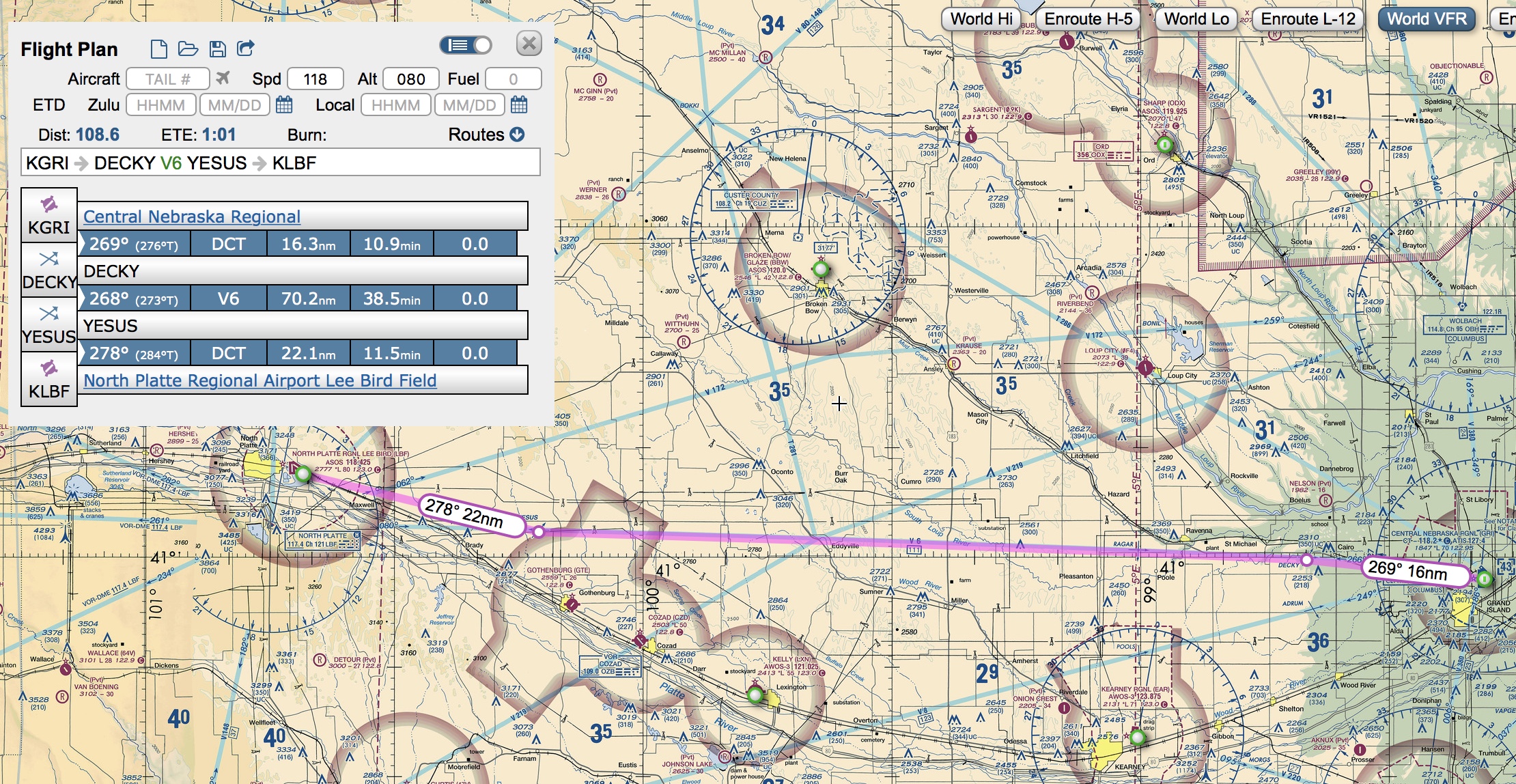
- I'll be following real flight plans created in SkyVector, using actual navaids and sky lanes.
- Real weather will be enabled (X Plane will constantly download real-life weather for where I'm flying). This means some of my flights might get scrubbed for bad weather.
- Ortho (satellite) photos will be used for the entire route, so what you see is what it really looks like.
- I'll fly Just Flight's PA28 Piper Warrior II. Aside from a Garmin 530, its tech is old-school, with standard gauges and a very basic autopilot.

Warrior II cockpit. Top: exhaust gas temperature, indicated airspeed, artificial horizon, altitude, NAV1 course deviation indicator, Garmin GPS; Bottom: ADF indicator, attitude indicator, directional gyro, vertical speed indicator, NAV2 course deviation indicator. Fuel gauges on the bottom. That's about it. There's an autopilot which controls pitch, but doesn't control altitude or vertical speed.
- My flight plan has 31 airports mapped out in SkyVector. Since the Warrior 2 has a range of 500 nautical miles, there will be small hops with overnight stays before moving on to another leg.
That's it! I'm looking forward to the sights, and learning to navigate cross-country.
Stay tuned.